Rwenzori Mountains National Park
The Mystical Challenge
Back in AD150, The geographer Ptolemy wrote about the snow-capped mountain range in the heart of Africa that, he claimed, was the source of the Nile and which he called the Mountains of the Moon. Seventeen centuries passed before the explorer Henry Stanly located such a mountain in western Uganda and established that though Lake Victoria is the primary source of the Nile, the greater river is also supported by the equatorial melting waters.
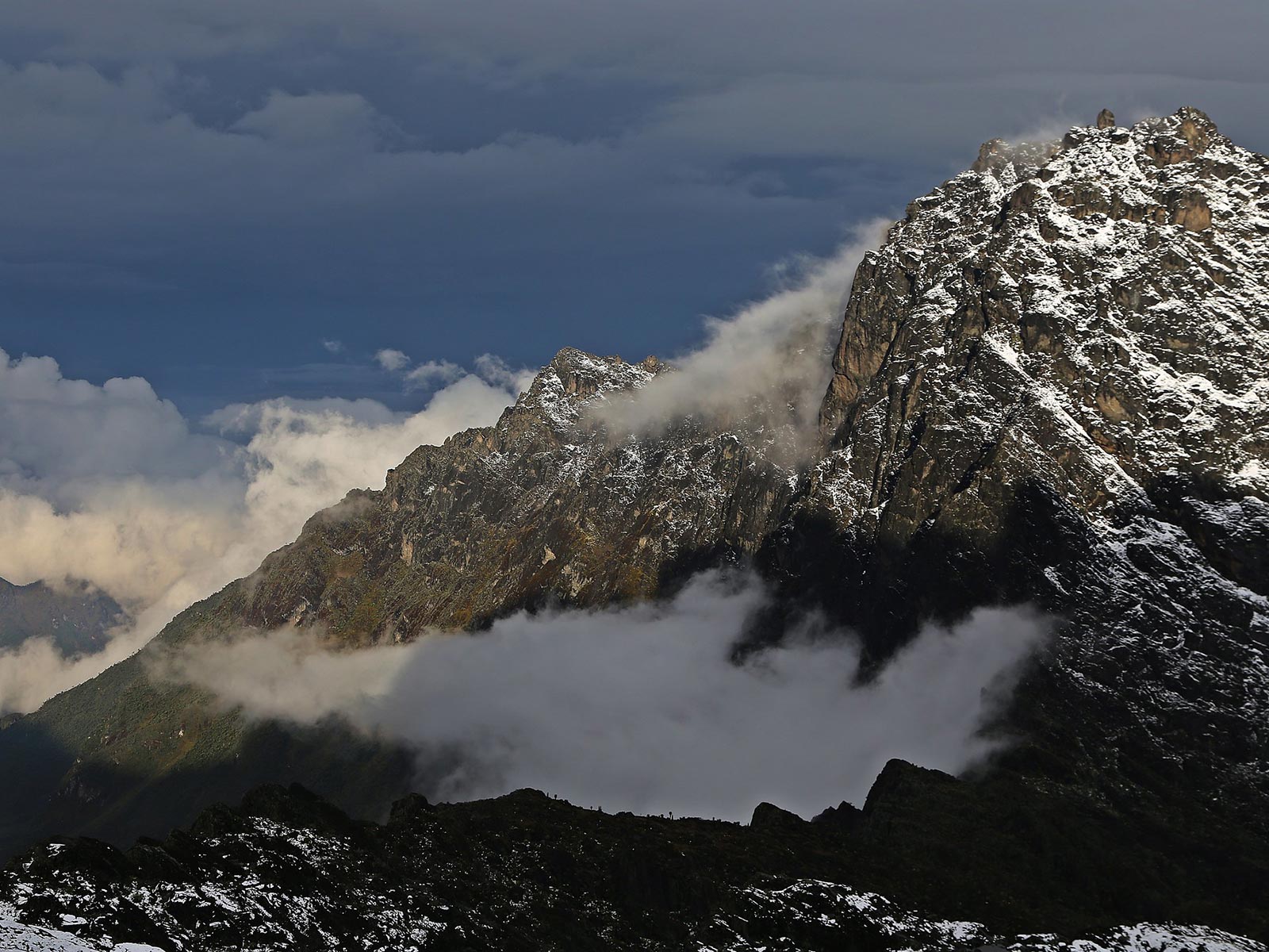
The Rwenzori has become established as one of Africa’s mountaineering adventure offering a chance to ascend the snow peaks and walk on equatorial glaciers that represent the highest and most intriguing source of the Nile. The high Rwenzori consists of six mountains; Stanely, Speke, Baker, Emin, Gessi and Savioa with Mt Stanley’s 5109m Margerita peak standing on Uganda Congo border as the highest point in Africa. The Uganda section of the mountain was gazetted as 995 km2 Rwenzori Mountains National Park in 1991 and was recognized as a world heritage site in 1994.
The Rwenzori Mountains National Park is home to 18 mammal species, 217 bird species, 9 reptile species, 6 amphibia species. Large mammals include elephant, buffalo, giant forest hog, bushbuck, chimpanzees and leopard are present in the forest zone but rarely seen
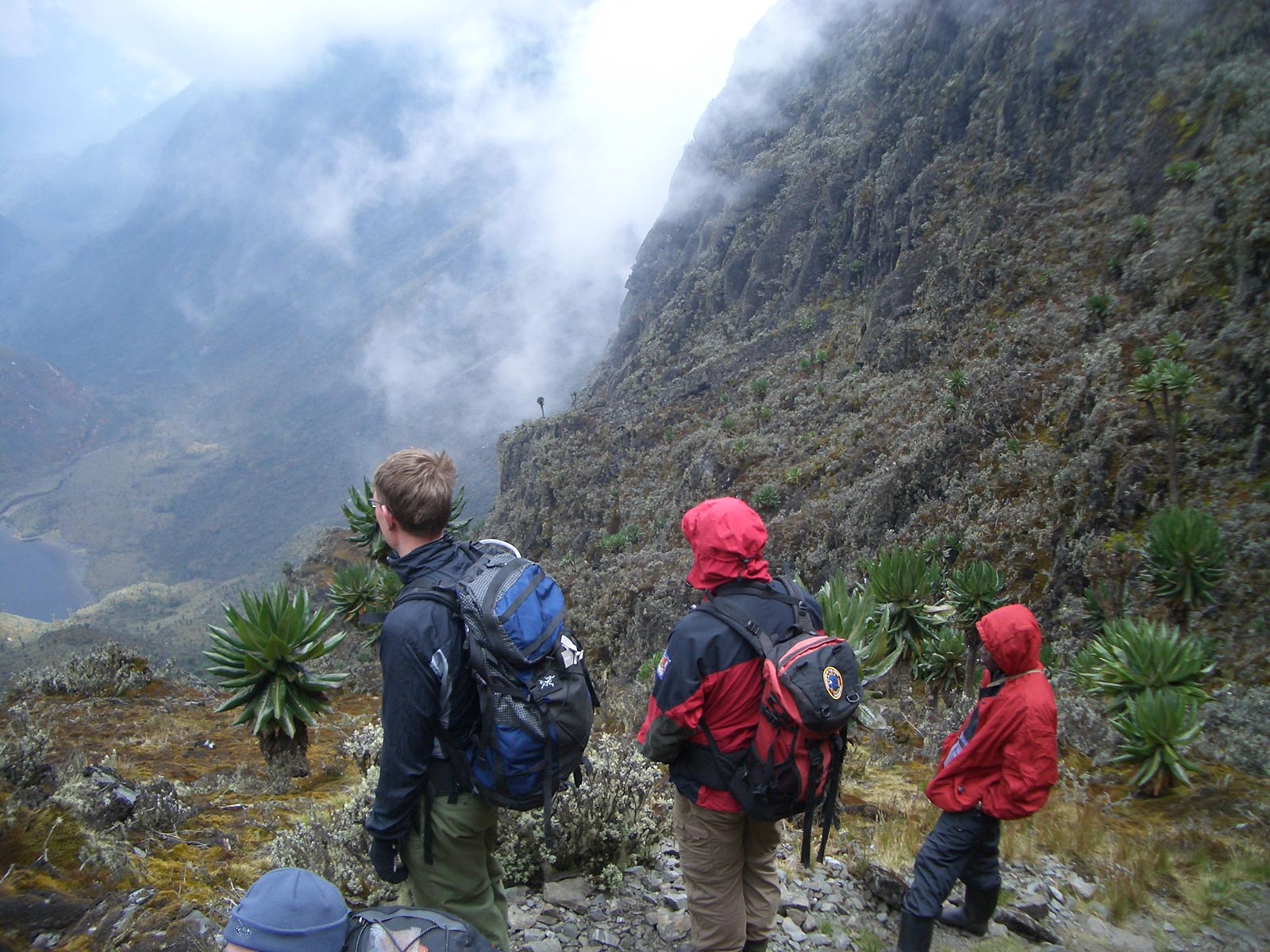
Activities/ Attractions in Rwenzori Mountain National Park
Mountain Trekking
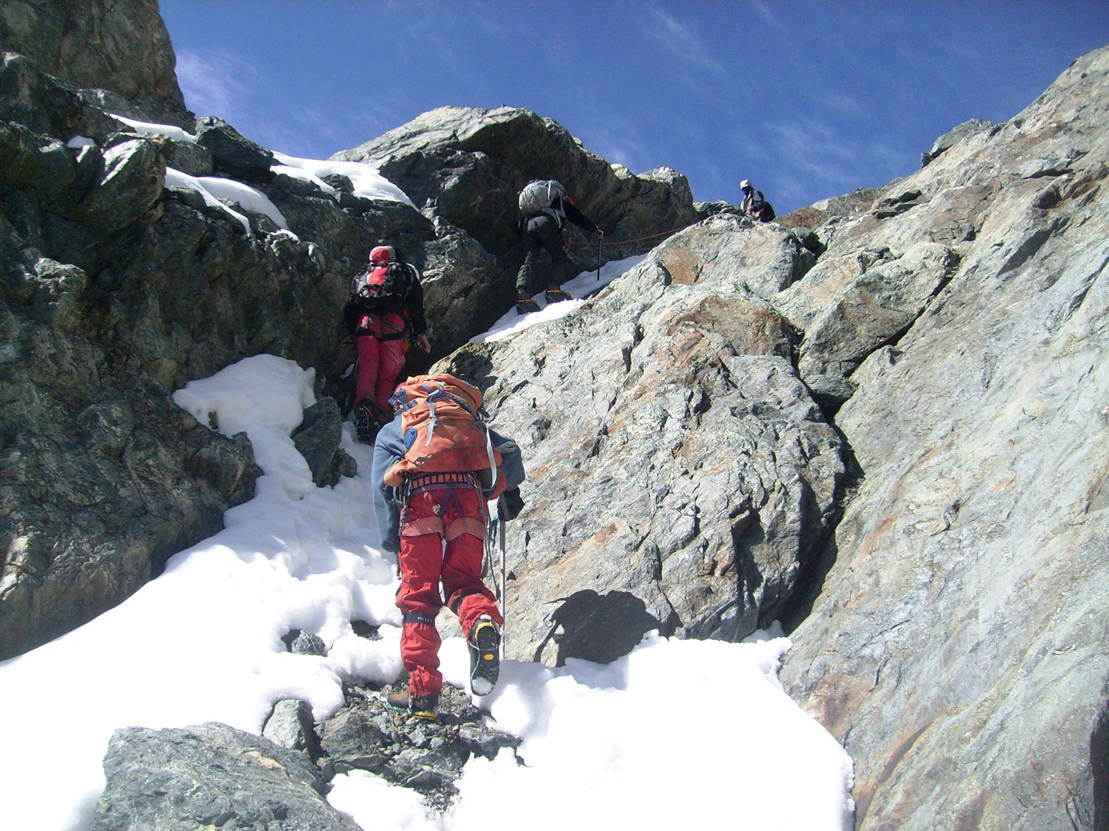
Three routes ascend to the high Rwenzori, The Rwenzori Trekking Services operates the Kilembe trail which enables 9 day expeditions to the summit Mount Stanley and a shorter 6 days option to Mt. Luigidasavoia is more accessible but equally scenic, The Nyakalengija based Rwenzori Mountaineering Services runs the central circuit which reaches and returns from Mount Stanley in 7 days. The Bakurungu Trail ascends from Kitumba to Mount Gessi. The mountain is best climbed during the drier months of January and June to July.
Peak Climbing
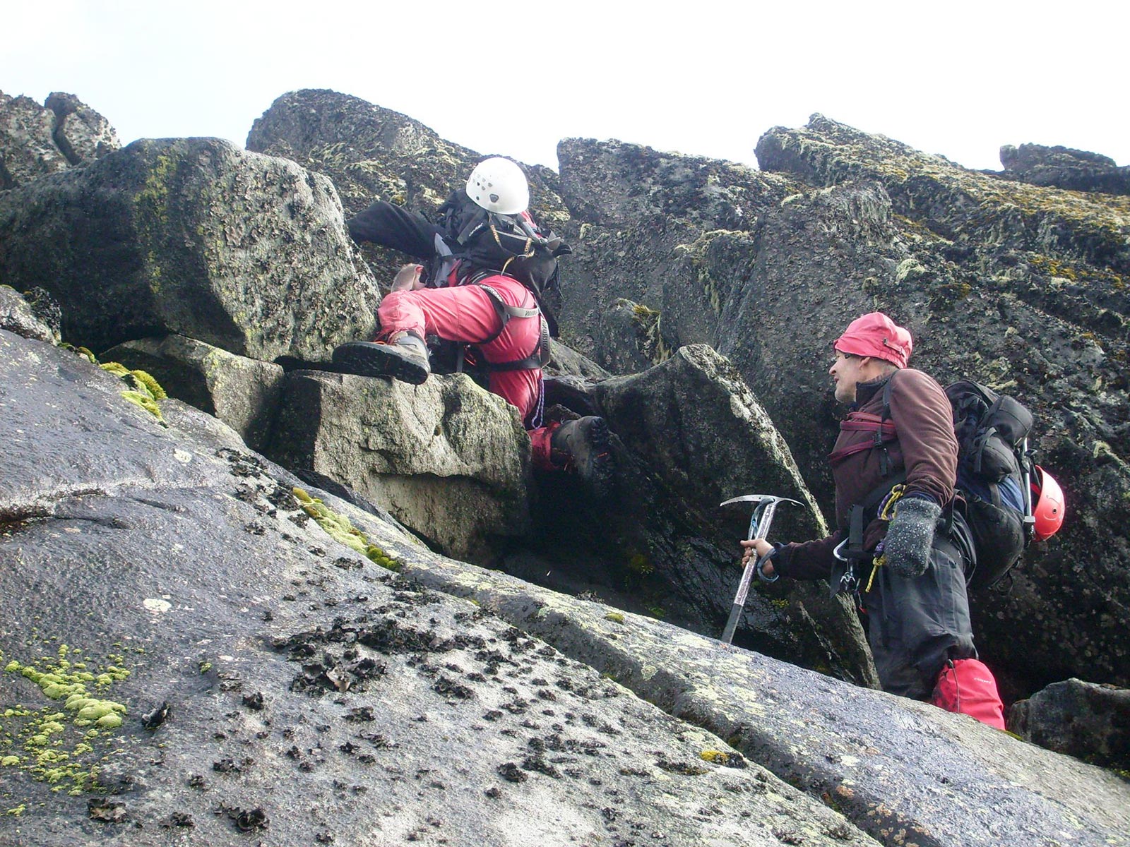
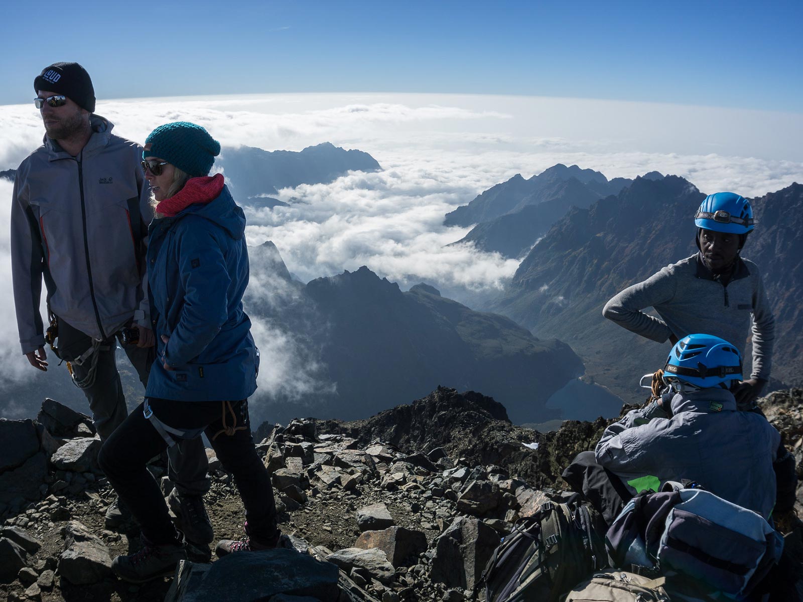
The highest peaks on Rwenzori’s six mountains can all be climbed. The most popular is 5109m Magherita, the highest point of Mount Stanley and the roof of the Rwenzori Mountains. Be aware that summiting on Stanley, Speke and Baker is a physically demanding activity, frequently in bad weather and for which specialist equipment and technical experience is required. Age is no barrier however; the oldest person to reach the Magherita peak was Ms. Beryl Park aged 78. Ascent of Mount Stanley requires a minimum of seven days on the mountain.
Hiking
The real appeal of the Rwenzori is the opportunity to hike through superb mountain scenery enlivened by equatorial snow and outlandish vegetation. With this in mind, shorter hikes are becoming increasingly popular. A detour on the Kilembe trail reaches 4627m Mt Luigi da Savoia which offers afro alpine vegetation, patches of equatorial snow and weather permitting grandstand views towards Mount Stanley, Nyakalejiga trailhead offers a 2 day hike to the scenic Lake Muhomain the bamboo forest. The Kazigo trail enables a day long traverse of the north Rwenzori ridge between the Fort Portal plateau and Bundibugyo town in the Semliki Valley on the west side of the mountain.
Forest Walks and Birding
The forest zone which occupies the lower contours of Rwenzori Mountain national park, can be visited as a day walk from Kilembe and Nyakalengija trail heads. Conveniently for birders the park’s birdlife is concentrated in this relatively accessible area. Species of interest include the Rwenzori Turaco and Rwenzori double collared sunbird, Rwenzori battis, handsome francolin, strange weaver, Rwenzori nightjar, Archers robin-chat and red throated alethe. Look out for other localized rarities such as the three horned chameleon and Rwenzori colobus monkey.
How to reach Rwenzori Mountains National Park
By Road
The Rwenzori mountains lie along the Uganda – Congo border in Western Uganda. The main trails are accessed from the tarmac Fort Portal – Kasese road. Kasese is 375km from Kampala via fort Portal (which is 300km from Kampala) and 450 km passing via Mbarara . The Kilembe trail head lies at the head of Nyamwamba valley, 15km west of Kasese. The Central circuit trail head is located in the Mubuku valley at Mihunga,22km from the Fort Portal – Kasese road, 25km north of Kasese. For the Bakurungu trail, turn off the main road at Nyakigumba, midway between Kasese and Fort Portal and drive for 6km to the trailhead St Katebwa.
By Air
Air transport can be arranged to Kasese from Kampala’s Kajjansi Airfield or Entebbe International Airport.
Best time of the year to visit Rwenzori Mountains National Park
The Rwenzori Mountain have also got a very short dry season which is between June and August and the other is between December and February. These are also the best times to visit this national park.
Make an Enquiry/ Talk to an Expert
Rwenzori Mountains National Park in Pictures

Our Recommended African Safari Ideas
Our itinerary ideas will give you a starting point for what your trip could entail. Treat them just as inspiration, as each trip is created uniquely for you and there are many more options available.


